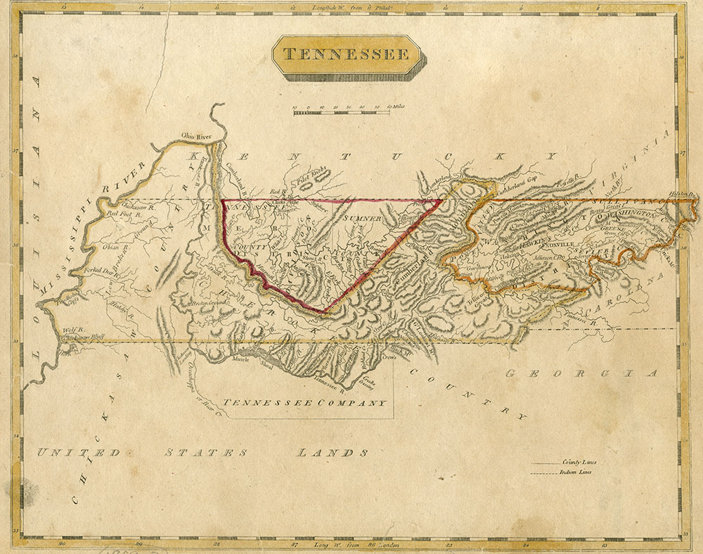
New tribes moved into the Tennessee region after Hernando DeSoto’s visit. The Cherokee built their towns and villages along the Hiwassee and Little Tennessee Rivers. The Chickasaw Nation controlled the territory west of the Tennessee River. The Shawnee, a large Ohio Valley tribe, moved south into the Cumberland River area but were driven out by Chickasaw and Cherokee attacks. The Creek, who never really lived in Tennessee, likely did spend time hunting in Middle Tennessee. After 1715, Middle Tennessee had no Indian towns, although several tribes used it as a common hunting ground.
In 1673, both British and French explorers claimed the region. James Needham and Gabriel Arthur, British traders from Charles Town (later Charleston), South Carolina, crossed the Appalachians to establish trade with the Cherokee. Father Jacques Marquette and fur trader Louis Joliet came down the Mississippi River and claimed its entire valley for the King of France. Britain and France later built forts and trading posts in the region to reinforce their competing claims.
The early fur traders lived among the Native Americans and employed them as hunters to supply them with beaver skins and deer pelts, or skins. The furs were then shipped downriver to New Orleans or carried on pack trains to Charles Town. Pack trains were lines of horses or mules that carried goods on their backs across the mountains. South Carolina merchants dominated the early Tennessee fur trade. In 1748, they exported more than 160,000 skins worth $250,000. In return for furs, Indians received cloth, iron goods, and guns. The fur trade was profitable for the traders, but it wiped out much of Tennessee’s native animal life. As the British and French competed for control of the valuable fur trade, they negotiated trade agreements and military alliances with Indian tribes. A military alliance is an agreement between two groups to assist each other in war.
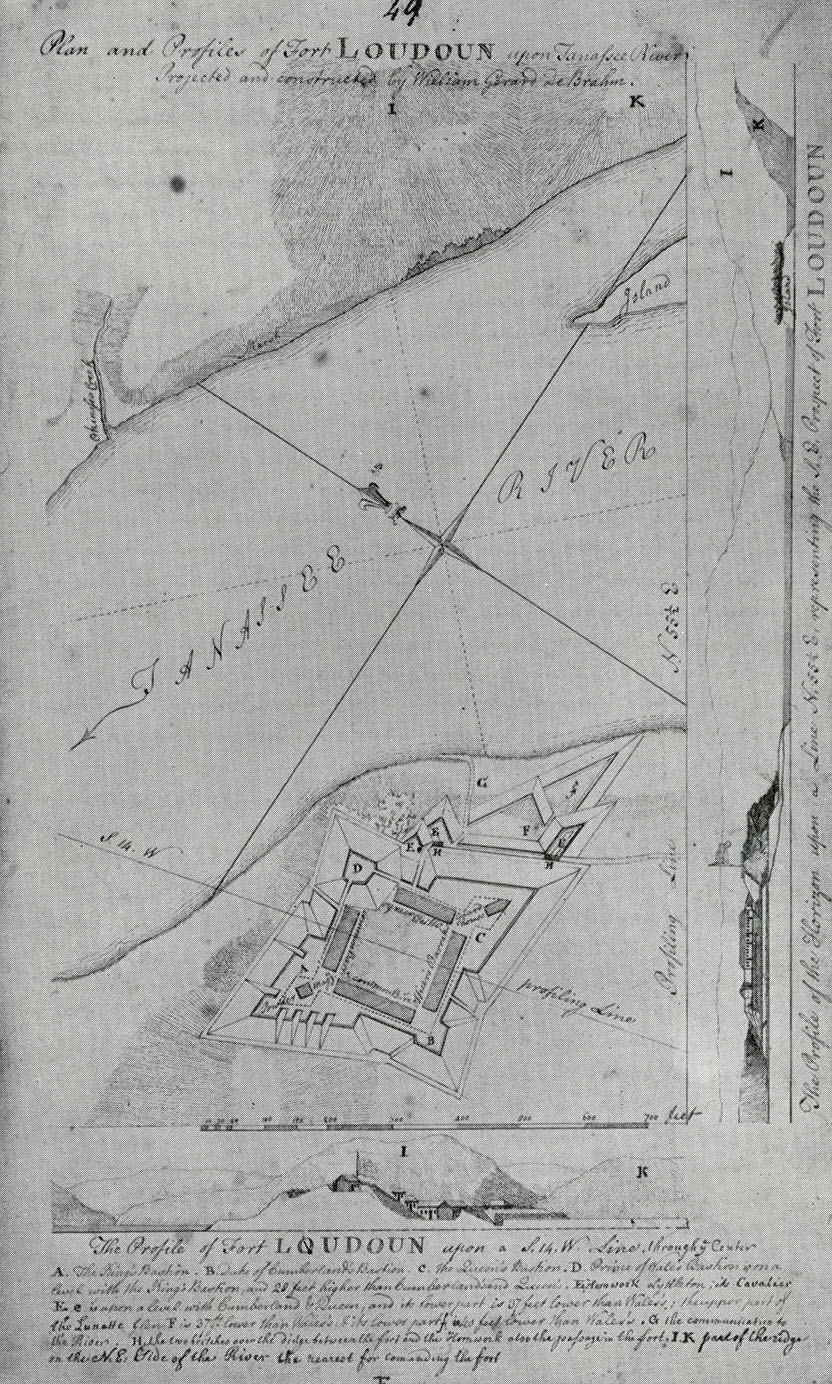
The competition between France and Britain for control of North America led to the start of the French and Indian War in 1754. Both the British and the French needed the help of their Native American allies in fighting the war. English soldiers built Fort Loudoun near present-day Vonore in an effort to keep the Cherokee loyal. However, the plan did not work. Cherokee warriors laid siege or surrounded the fort and starved out the soldiers inside. After surrendering the fort, the retreating soldiers were attacked by the Cherokee, and many soldiers were killed. The British eventually won the war despite their loss at Fort Loudoun. As a result, France ceded, or gave up, all its claims to land east of the Mississippi River in 1763. Tired after years of fighting, the British hoped to avoid further conflict with Native Americans by prohibiting settlements beyond the Appalachian Mountains in the Proclamation of 1763. Although still powerful, the Cherokee had lost some of their independence by forming military alliances and trading with Europeans. Their lands, moreover, were directly in the path of migration across the mountains.
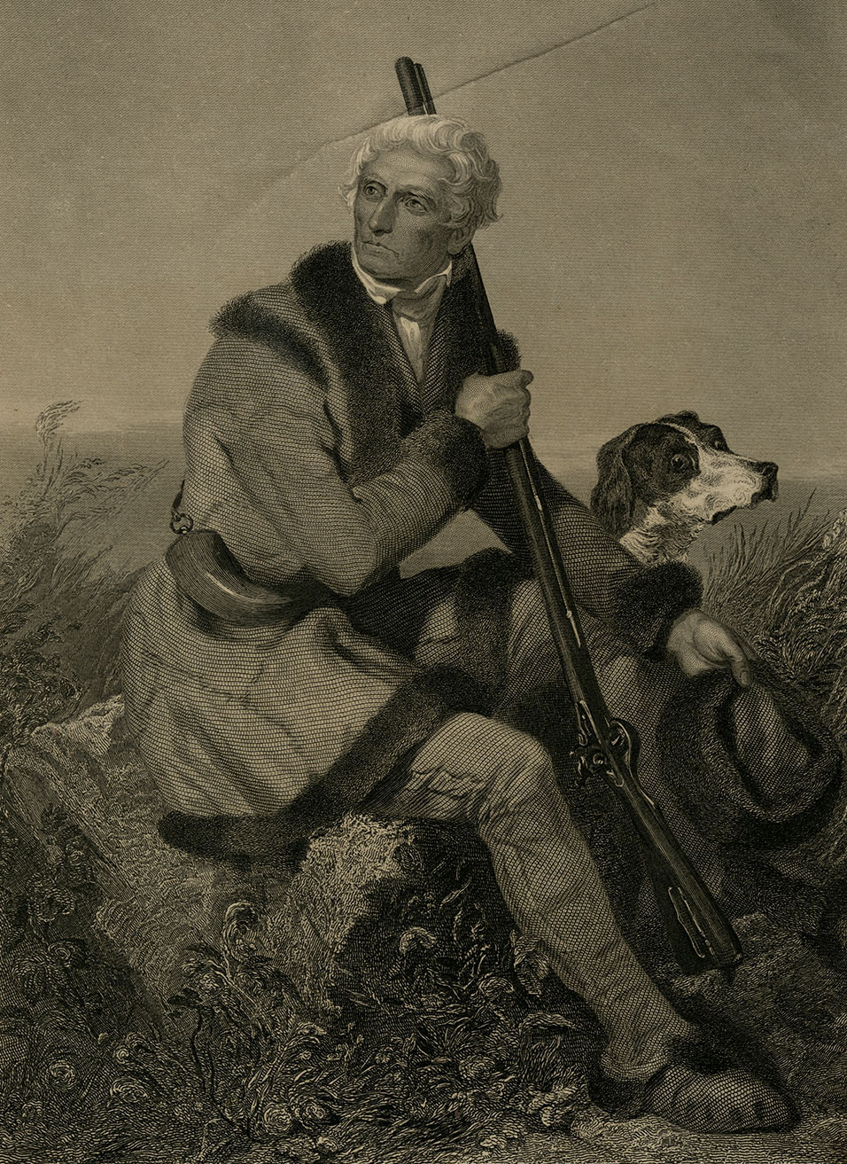
As early as 1750, colonial explorers began to cross the mountains and explore Cherokee lands. While working for the Loyal Land Company of Virginia, Dr. Thomas Walker discovered the Cumberland Gap. A gap is a low area between mountains. The Cumberland Gap was used by Native Americans and later by colonial settlers to reach Tennessee and Kentucky. Throughout the 1750s and 1760s, longhunters crossed the mountains into Cherokee territory. Longhunters earned their name by hunting for six to seven months before returning home. The longhunters shared their knowledge of the lands west of the Appalachian Mountains which encouraged settlers like William Bean to ignore the Proclamation of 1763 and move west into the valleys of East Tennessee.
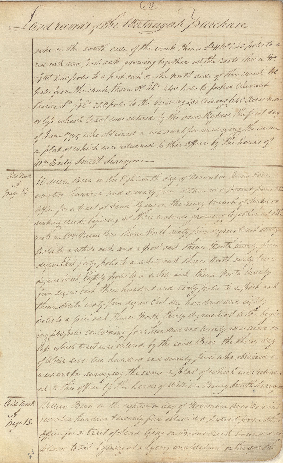
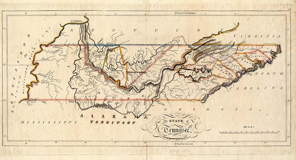
By the early 1770s, four different communities had been established in northeastern Tennessee—on the Watauga River, the North Holston, the Nolichucky, and in Carter’s Valley. The settlers claimed that they were living on land that was part of Virginia, but a land survey showed that claim to be false. A land survey locates, describes, and maps the boundaries of a piece of land. Because the Proclamation of 1763 prohibited buying land from the Cherokee, the settlers negotiated leases for their farms instead. Since Watauga and the other settlements were outside the boundaries of the colonies, colonial law did not apply. As a result, the independent-minded settlers created their own government in a document called the Watauga Compact in 1772.
In addition to settlers, land speculators from Virginia and North Carolina also raced to acquire western lands. Land speculators were businessmen who obtained cheap land from the Native Americans, hoping to resell it at a profit to incoming settlers. In March of 1775, Richard Henderson of North Carolina negotiated a private treaty with the Cherokee for the purchase of twenty million acres of land that included most of Kentucky and Middle Tennessee. In return, the Cherokee received six wagon loads of goods worth about 10,000 English pounds. The deal was known as the Transylvania Purchase. Henderson hired Daniel Boone to cut a trail through the Cumberland Gap that became known as the Wilderness Road. A few days later, the settlers asked the Cherokee to turn their lease into a purchase. Cherokee leaders such as Little Carpenter agreed, and the deal became known as the Watauga Purchase. Other Cherokee leaders were opposed to any plan to sell their ancestral lands. Dragging Canoe warned the settlers that they were purchasing a “dark and bloody ground.” He retreated south to establish the warlike Chickamauga tribe, which attacked Tennessee settlements for the next twenty years.
The Wataugans’ willingness to ignore the Proclamation of 1763 and purchase land from the Cherokee demonstrated their contempt for the strict rules of the British government. Despite their isolation, the Wataugans were aware of the increasing anger towards the British government demonstrated in events such as the Boston Massacre and the Boston Tea Party. However, the Wataugans’ most important problem was continued hostility from the Cherokee. The Cherokee, angry about losing more and more land to the settlers, allied themselves with the British in the Revolutionary War. Concerned about the safety of the settlements, the Wataugans asked North Carolina for help in a document known as the Watauga Petition. A petition is a formal written request to a person or group, such as a government. North Carolina agreed to help, and the settlements became a part of the state known as the Washington District.
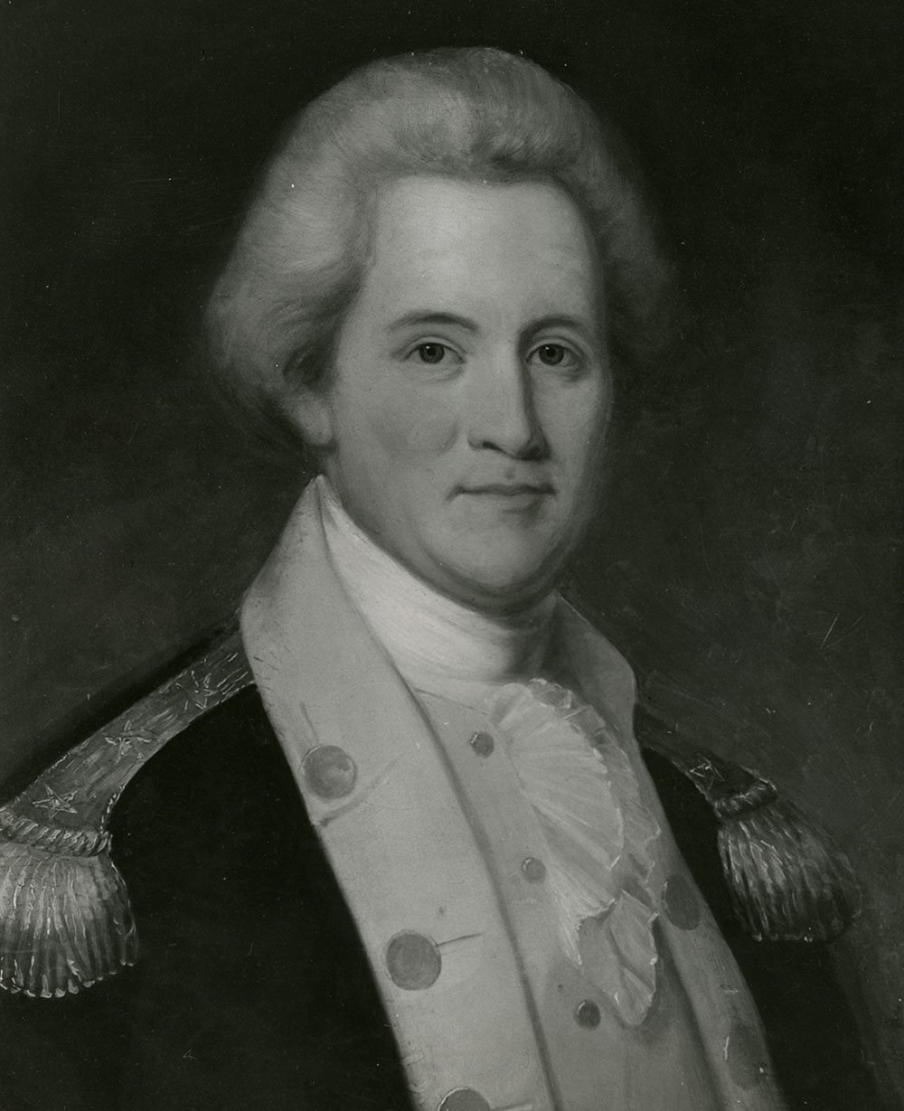
In July 1776, the Cherokee launched well-planned attacks on the East Tennessee settlements. The Wataugans, led by their popular leader John Sevier, stopped the Cherokee and swiftly counterattacked. The settlers were helped by Cherokee leaders who wanted to avoid war, such as Beloved Woman Nancy Ward. Militia from North Carolina and Virginia assisted the Wataugans as well. Militia are groups of ordinary citizens who fight in times of emergency. The Wataugans invaded Cherokee territory and burned several towns. This series of battles is known as the Cherokee War. The alliance with Britain was a mistake for the Cherokee. The alliance gave the Americans an excuse to reduce the tribe’s military power and take more land after the war. Following the Cherokee War, the Wataugans focused on matters at home until the fall of 1780. Responding to a threat made by British Major Patrick Ferguson, John Sevier and Isaac Shelby led a group of militiamen over the mountains to fight Ferguson and his Tory, or Loyalist, troops at the Battle of Kings Mountain on October 7, 1780. The Overmountain Men were joined by militia from Virginia and North Carolina. The Patriot force defeated Ferguson’s troops and set in motion the chain of events that ended one year later with Cornwallis’s surrender at Yorktown.
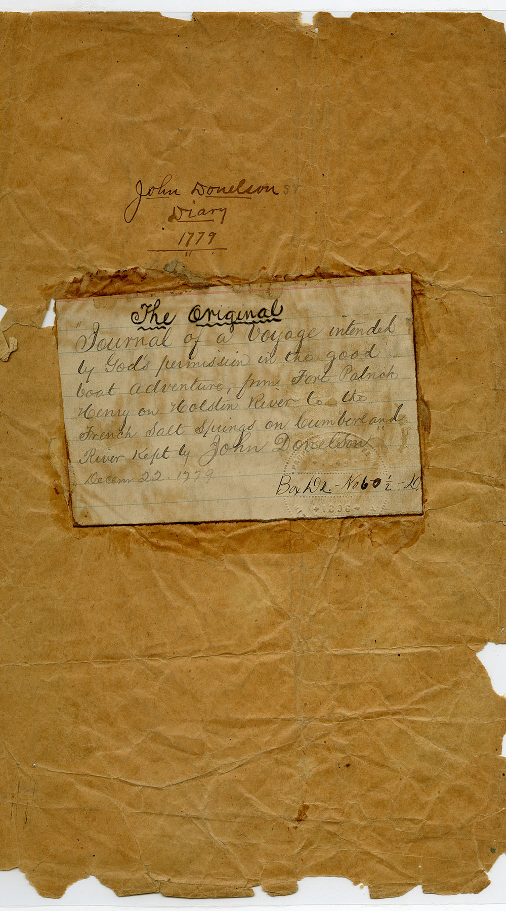
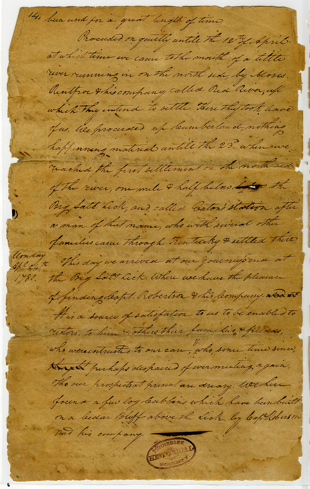
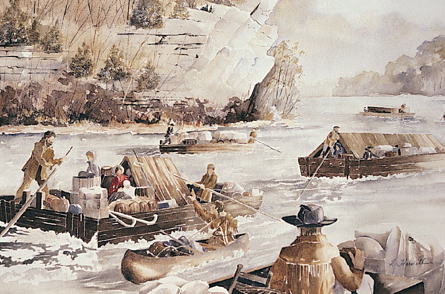
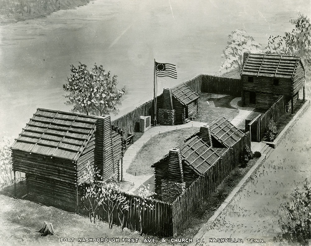
The Revolution gave settlers an opening to push the frontier westward to the Cumberland River. Longhunters such as James Robertson, Kasper Mansker, and Thomas Sharpe Spencer had hunted and trapped through Middle Tennessee and spoke of its richness to their neighbors at home. Following the Transylvania Purchase, Henderson hired Robertson to plan a settlement along the Cumberland River. In the winter and spring of 1779, 300 pioneers made the difficult trek to French Lick, the future site of Nashville. French Lick was the location of a natural salt lick along the Cumberland River that had been the location of a French trading post. Most of the men came overland under Robertson’s leadership, while John Donelson led a flotilla, or fleet of ships, carrying women, children, and enslaved people on a hazardous voyage down the Tennessee River and up the Cumberland River. The travelers endured freezing temperatures and attacks from the Chickamauga before reaching their destination. Because the Cumberland Settlement was outside the boundaries of the colonies, the settlers formed their own government in a document known as the Cumberland Compact. This first band of settlers established a number of fortified stations and spread across the Central Basin in search of good farmland. Stations were log homes surrounded by walls and used as forts during attacks. The Cumberland settlers withstood fourteen years of brutal attacks by Creek and Chickamauga warriors from the Tennessee River towns, including the Battle of the Bluffs in 1781. Nearly all of the early families lost someone in the fighting, but the Cumberland Settlements survived. More settlers came, and in time, the threat of attacks by Native Americans faded. Traders, hunters, and land speculators had found the Tennessee country, but it was the farmers that would make it a state.